
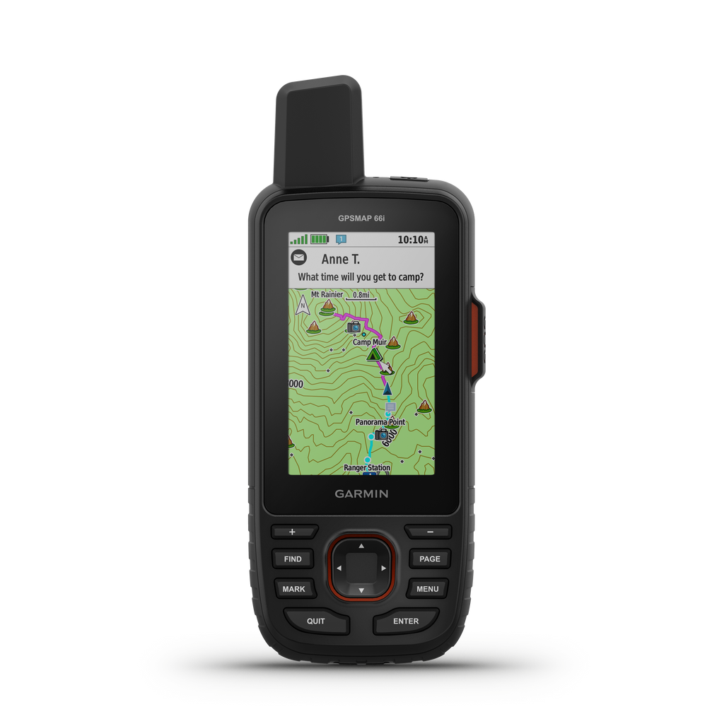


The Garmin GPSMAP 66i GPS handheld receiver is a rugged, high-performance device with wireless connectivity. It features a 3 inch sunlight-readable color screen that supports BirdsEye™ Satellite Imagery (no annual subscription) plus multiple Global Navigation Satellite Systems (GNSS) support and navigation sensors. Other salient features include 3-axis tilt-compensated compass and barometric altimeter. It is compatible with Garmin Explore™ website and app to help you manage waypoints, routes, activities and collections, use tracks and review trip data from the field.
The GPSMAP 66i triggers an interactive SOS to the GEOS 24/7 search and rescue monitoring center, two-way messaging and live location sharing via the 100% global Iridium® satellite network (satellite subscription required). The GPSMAP 66i when paired via Bluetooth® technology to a compatible smartphone keeps informed of the weather conditions. It also lets you know Active weather for up-to-date forecasts, including predictive maps for temperature, wind, precipitation, clouds and Geocaching Live.
GPSMAP 66i Features:
PHYSICAL:
MAPS / MEMORY:
SPECIALIZED FEATURES:
The GPSMAP 66i triggers an interactive SOS to the GEOS 24/7 search and rescue monitoring center, two-way messaging and live location sharing via the 100% global Iridium® satellite network (satellite subscription required). The GPSMAP 66i when paired via Bluetooth® technology to a compatible smartphone keeps informed of the weather conditions. It also lets you know Active weather for up-to-date forecasts, including predictive maps for temperature, wind, precipitation, clouds and Geocaching Live.
GPSMAP 66i Features:
PHYSICAL:
- Unit Dimensions (W x H x D): 2.6” x 6.4” x 1.4” (6.6 x 16.3 x 3.5 cm)
- Display Size (W x H): 1.5"W x 2.5"H (3.8 x 6.3 cm); 3" diag (7.6 cm)
- Display Resolution (W x H): 240 x 400 pixels
- Display Type: Transflective Color TFT
- Weight: 8.5 oz (241 g) w/ Batteries
- Battery: Rechargeable, Internal Lithium-ion
- Battery Life: Upto 35 hrs at 10-min Tracking; Upto 200 hrs at 30-min Tracking (power save mode)
- Waterproof: Yes (IPX7)
- High Sensitivity Receiver: Yes
- Interface: High-Speed USB & NMEA 0183 Compatible
MAPS / MEMORY:
- Basemap: Yes
- Preloaded Maps: yes (topographic)
- Ability To Add Maps: yes
- Built-in Memory: 16 GB
- Accepts Data Cards: microSD™ Card (Not Included)
- Waypoints/Favorites/Locations: 10000
- Routes: 250
- Track Log: 20,000 Points, 300 Saved Tracks
SPECIALIZED FEATURES:
- Automatic Routing
- Turn By Turn Routing On Roads - Electronic Compass
- Keeps Your Bearing Whether You Are Moving Or Not - Barometric Altimeter
- Tracks Changes In Pressure to Pinpoint Your Precise Altitude - Geocaching- Friendly (Paperless)
- Custom Maps Compatible
- Custom Maps Offer Practicality & Convenience In Everyday Situations - Hunt/Fish Calender
- Sun & Moon Information
- Area Calculation - Ability To Add Additional Points Of Interest
- BirdsEye Direct To Device
- No Annual Subscription Required - Smart Notifications: yes
- Picture Viewer
- Garmin Explore Compatible
- Garmin Conncet™ IQ Compatible
- Online Community Where You Analyze, Categorize & Share Data - Live Tracking: Yes
Includes:
- GPSMAP 66i
- Access to Birdseye Satellite Imagery
- USB cable
- Carabiner Clip
- Documentation
Compatible with:
- fenix ®: 55 Plus